")
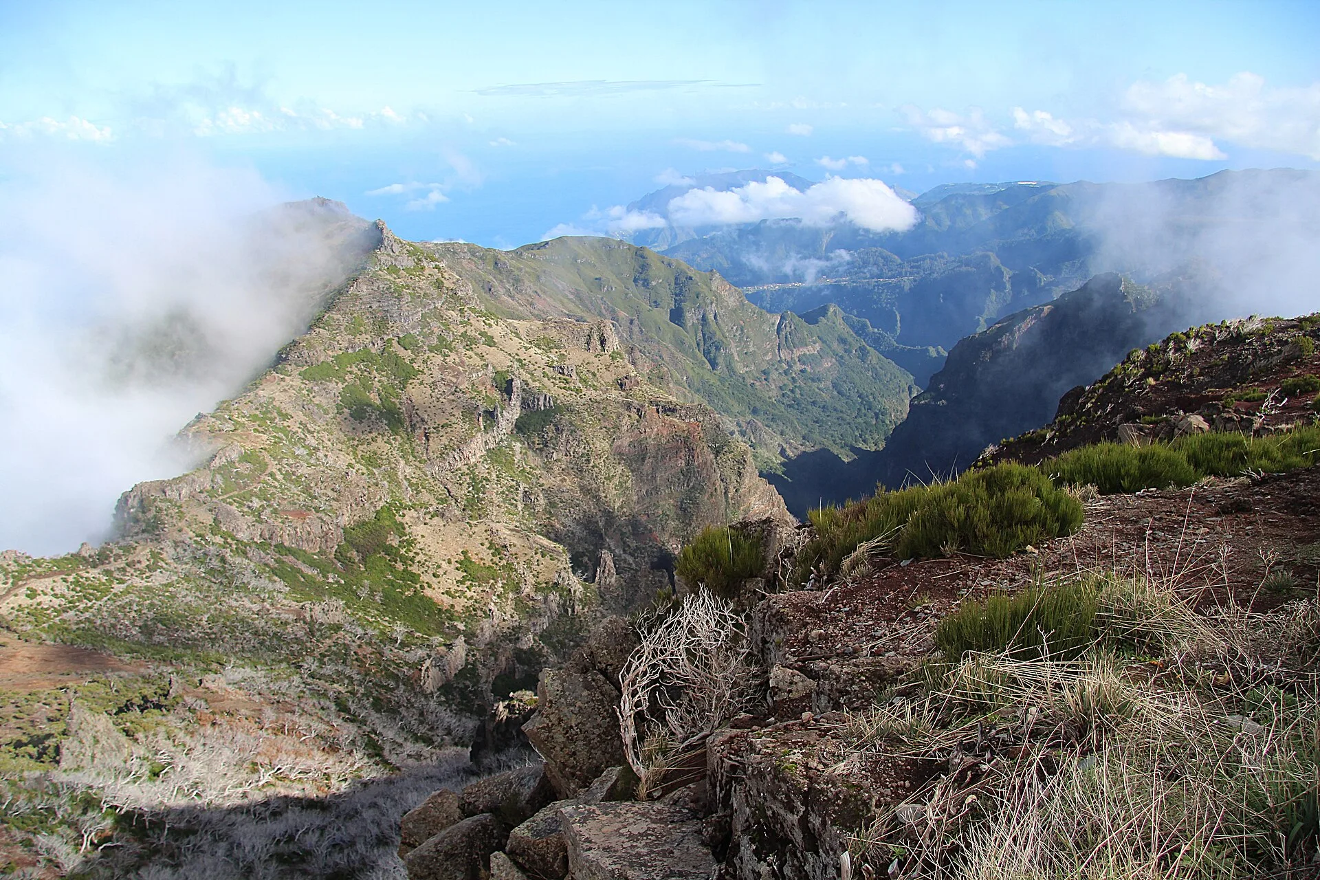
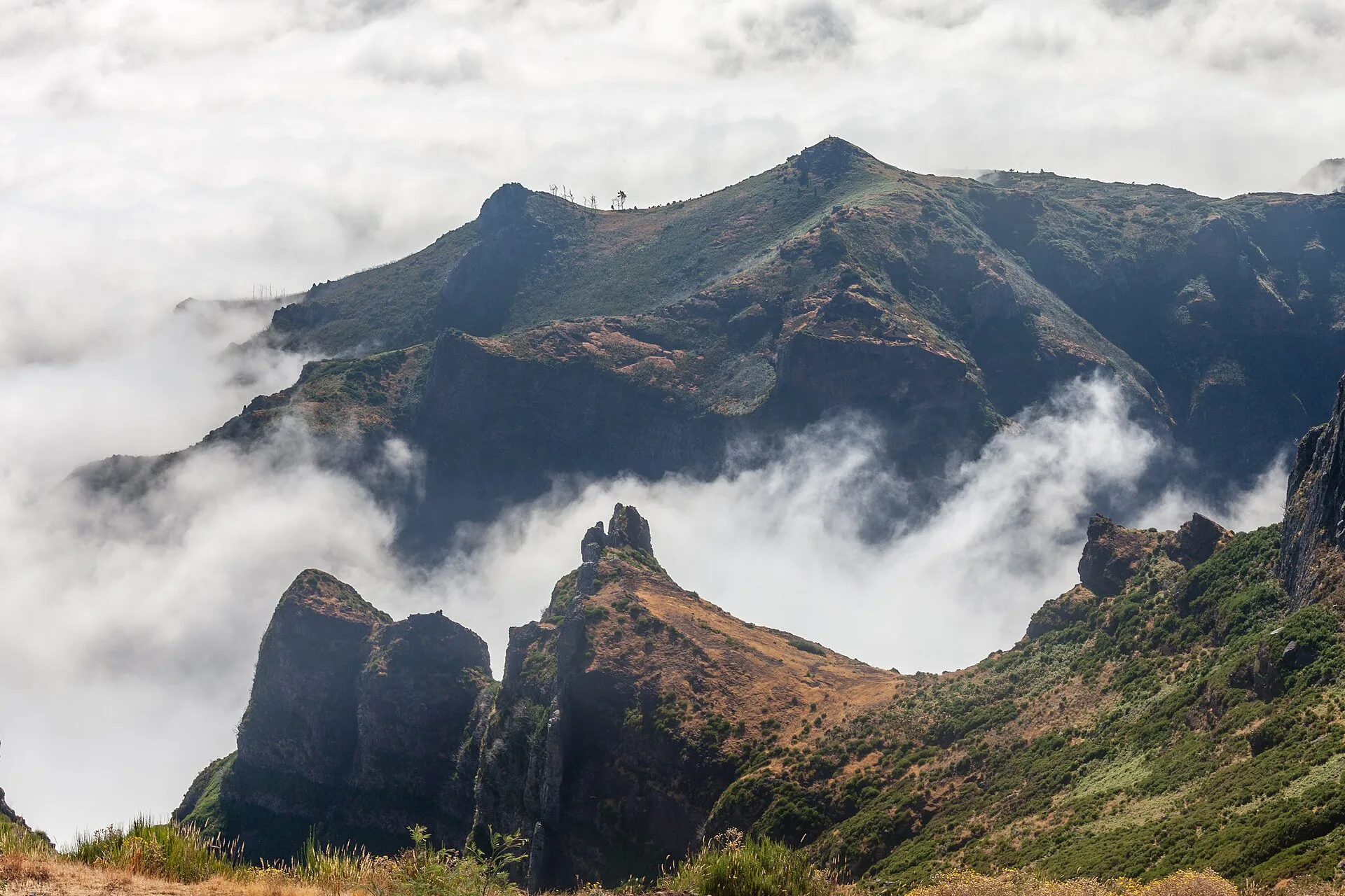
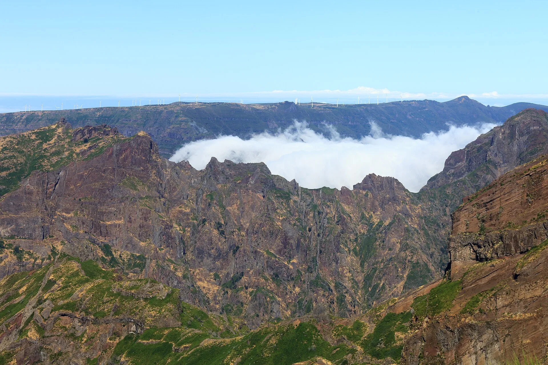
Pico do Areeiro is one of the best-known places on the island of Madeira and one of its highest points, at an altitude of 1,818 metres. According to the official tourism information, it is the third-highest point on the island, which helps explain the breadth of the views enjoyed from there.
From the summit, the horizon opens over Madeira’s mountain massif and the Atlantic Ocean. From this elevated viewpoint, visitors can look across the central mountain range and, in good visibility, see Ponta de São Lourenço, Curral das Freiras and, on clear days, the island of Porto Santo. These references show that Pico do Areeiro works as a wide-ranging panoramic viewpoint, with views over different parts of the archipelago and the island landscape.
The official source also describes it as a cinematic mountain backdrop. The combination of altitude, relief and maritime panorama makes the site especially memorable for people who visit. The same source says that Pico do Areeiro is one of the most visited places on the island, mainly because of its good access and the facilities available there. These features help explain its role as both a scenic and tourist point of interest in Madeira.
Another highlighted aspect is the visual spectacle that can be enjoyed at sunrise, weather permitting. The official information says this moment has attracted more and more curious visitors, as well as many photography lovers. Pico do Areeiro is therefore not only a daytime viewpoint, but also a place associated with watching morning light over the mountains and the island.
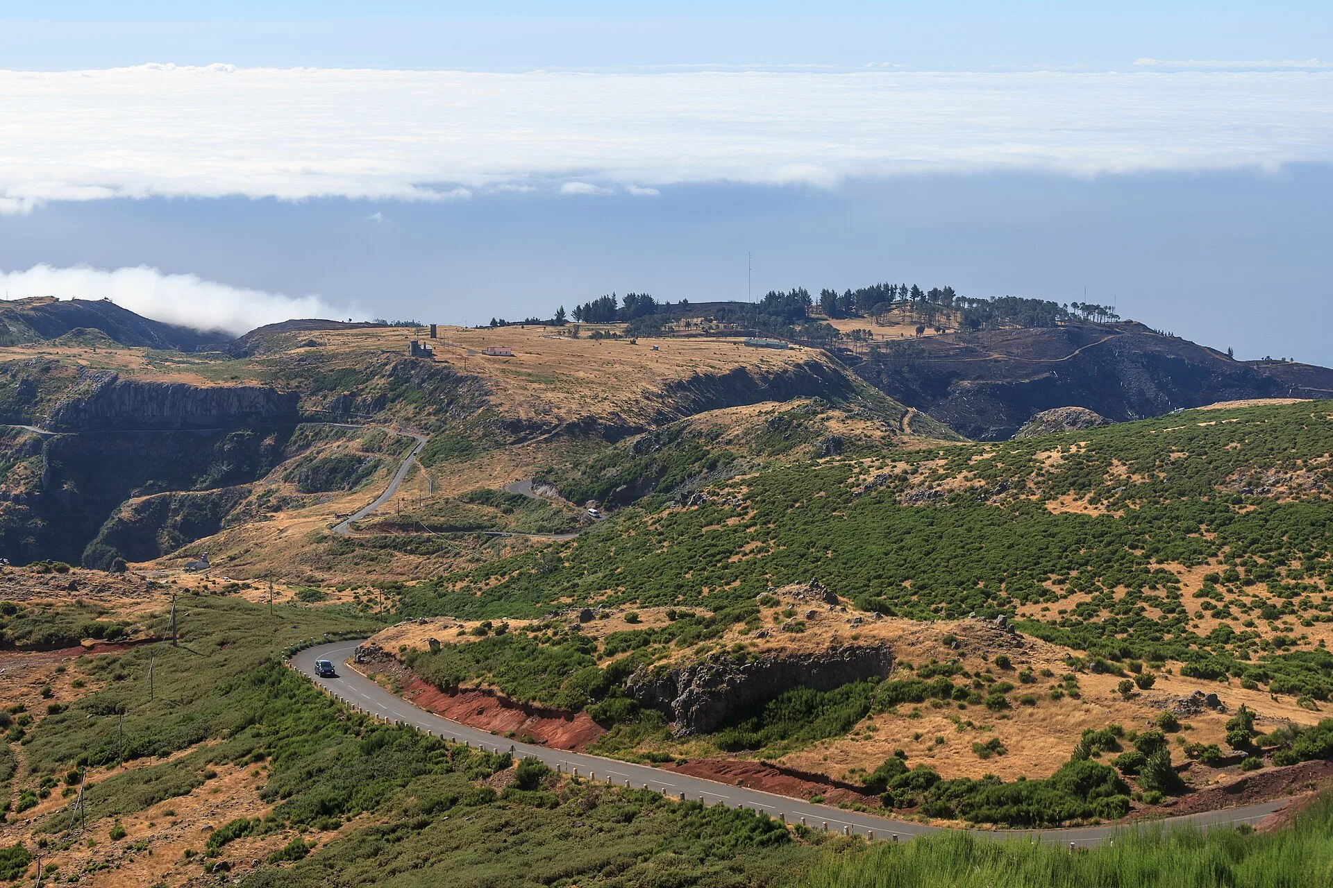
Beyond the view itself, Pico do Areeiro is also important as the starting point of one of Madeira’s most notable hiking routes. From here begins PR1 – Vereda do Areeiro, a trail that heads towards Pico das Torres, at 1,851 metres, and then ends at Pico Ruivo, the highest point in the archipelago, at 1,862 metres. This connection places Pico do Areeiro at the heart of one of the island’s most emblematic mountain walks mentioned in the official documentation.
The second document supplied by the Institute for Forests and Nature Conservation confirms the importance of PR1 as a route extending to Pico Ruivo and states that the trail is carried out in the direction Pico do Areeiro – Pico Ruivo. Although that note is related to operational conditions on the trail, it still reinforces Pico do Areeiro’s central role as the starting point of the crossing.
In geographical terms, Pico do Areeiro is part of Madeira’s network of high points and is presented by the official tourism body within the section dedicated to the Madeira Peaks. Its altitude, its setting within the mountain massif and its link to the PR1 trail make it a place where landscape, observation and hiking come together. For that reason, Pico do Areeiro is widely understood as one of the island’s most representative mountain viewpoints and access points.
In short, Pico do Areeiro stands out for three well-documented characteristics: its 1,818-metre altitude, its wide views over Madeira and the Atlantic, and its role as the gateway to the Vereda do Areeiro. These elements explain its prominence and its place among Madeira’s leading scenic attractions.