")
Pico Ruivo is one of the most iconic places on Madeira island. At 1,862 metres above sea level, it is the highest point in the Madeira archipelago and the third-highest point in Portugal. Located in the municipality of Santana, it stands in the island’s Central Mountain Range and is therefore closely associated with both landscape appreciation and mountain walking.
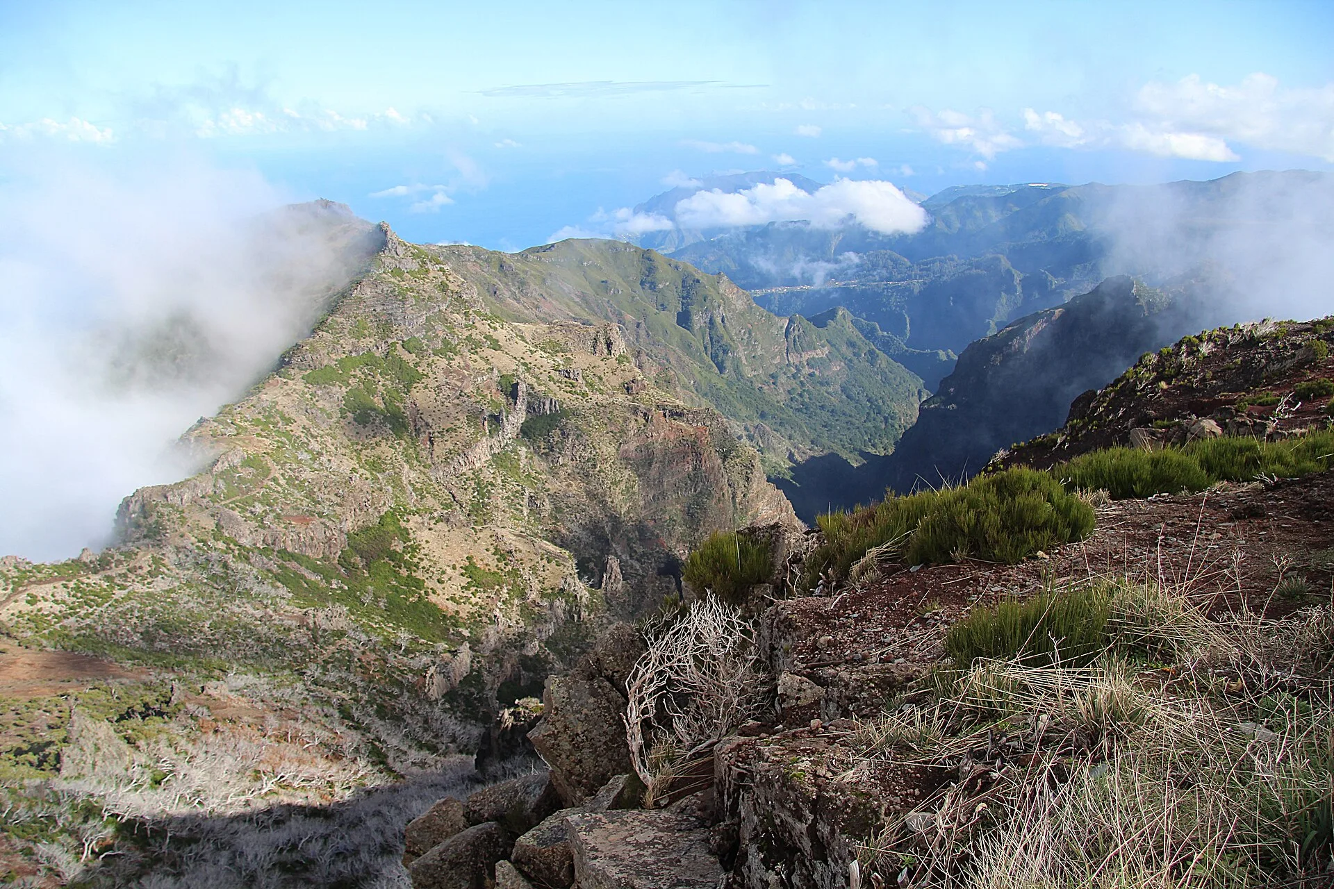
Official tourism information describes Pico Ruivo as a place with an exceptionally wide panorama. From the summit, visitors can see several parts of Madeira, including the Curral das Freiras parish, the municipality of Câmara de Lobos, the various achadas of Santana, and the impressive depth of the Ribeira Grande and São Jorge valley. On days of excellent visibility, it is also possible to see Porto Santo Island and the Desertas Islands group. The broad reach of these views is one of the main defining features of the place, which is presented as a site worth visiting with time set aside for contemplation.
The natural setting of Pico Ruivo is shaped by its altitude. As the highest point in the archipelago, its flora is mainly made up of high-altitude heaths. The landscape is dominated by large rock formations, which often rise above the clouds. The sources also mention frequent birdlife here, including the Madeira firecrest (Regulus ignicapus madeirensis), the chaffinch (Fringilla coelebs) and the common linnet (Linaria cannabina).
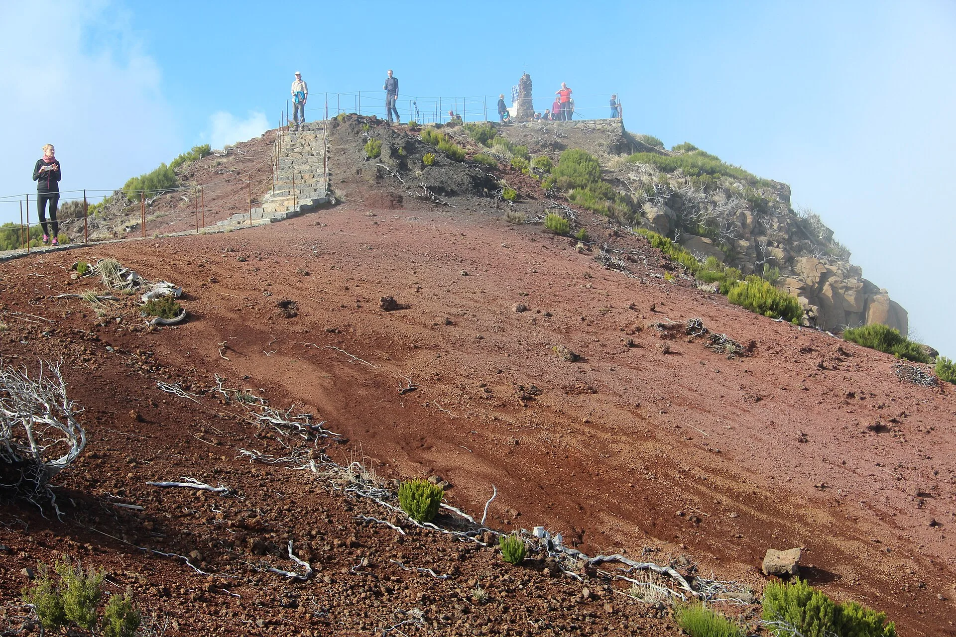
Access to Pico Ruivo is on foot, through the Madeira network of recommended and classified walking trails. The Institute of Forests and Nature Conservation lists the Vereda do Pico Ruivo (PR 1.2), a 2.8 km trail between Achada do Teixeira and Pico Ruivo, as open. It also identifies the Vereda do Areeiro (PR 1), a 6.1 km trail between Pico do Areeiro and Pico Ruivo; in the status shown in the source at the time, it is open, though with the note that it was only passable from Pico do Areeiro to Miradouro da Pedra Rija, at km 1.2. The source also mentions that Pico Ruivo can be reached from Pico do Areeiro by following PR 1.1. The Vereda da Ilha (PR 1.1), at 8.2 km, is likewise associated with the route between Pico Ruivo and Ilha.
In practical terms, the sources present Pico Ruivo as a mountain site of clear natural and scenic importance, directly linked to classified hiking routes and to wide views over the island and the ocean. The official information available emphasises three main aspects: height, landscape and pedestrian access. Together, these explain why Pico Ruivo holds such a significant place in Madeira.
Because it belongs to the classified trail network, the IFCN source also notes that, from 1 January 2026, a new system of fees and reservations applies to access to classified walking routes, with exemptions for Madeira residents, children aged 12 or under, and people with disabilities of 60% or more, as well as their accompanying tutors when present, subject to proof. This applies to the classified trail network that includes Pico Ruivo.